

About this Event
Join us for a guided walk and discover how the highest tides of the year give us a glimpse into the future of sea level rise. We'll learn what King Tides are, how sea level rise is reshaping our coastal communities, why habitat restoration matters and how you can contribute as a community scientist.
We’ll walk along Bedwell Bayfront Park and Refuge trails, where we'll observe plant adaptations and discuss the impacts of rising oceans. You’ll also learn how to contribute to the California Coastal Commission's King Tides Project by uploading photos through the Survey123 website or app - a statewide effort to record changes to our coast and estuaries. Your photos will be added to a map of this season's King Tides photos.
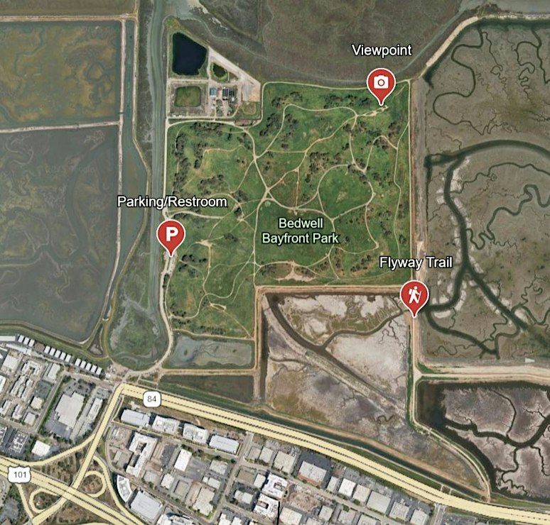
We'll meet in the Bedwell Bayfront Park parking lot, adjacent to the bathrooms, before walking to an overlook at Bedwell Bayfront Park, and then continue to the Refuge's Flyway Trail. The trail is compacted dirt and gravel with some elevation gain. We will be walking at a slow pace for approximately 2 miles.
Stay until 12:00pm for a bonus guided tour of the Flyway Trail!
Location: Flyway Trail, adjacent to Bedwell Bayfront Park and right off of Highway 84.
Parking: Bedwell Bayfront Park, 1600 Marsh Road, Menlo Park, CA 94025.
This interactive event is suitable for all ages. Heavy rains will cancel the event.
Egrets photo by Larry Rosenblum
High tide photo by Aja Yee
This program is brought to you by (SFBayWS), the nonprofit Friends Group of the SF Bay National Wildlife Refuge Complex, and Meta.
Event venue & nearby stays
Flyway Trail-Don Edwards San Francisco Bay NWR-Ravenswood Unit, 1600 Marsh Road, Menlo Park, United States
 Concerts, fests, parties, meetups — all the happenings, one place.