About this Event
The Department of Mines, Industry Regulation and Safety offers FREE introductory information sessions in the use of databases and online systems. The presentations allow hands-on interaction for most systems.
A desktop computer will be available for each participant, attendees should have proficient computer skills. There is no need to bring anything. However, you are welcome to bring your own laptop if you want to run through specific examples.
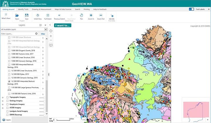
GeoVIEW.WA is an online GIS-based mapping tool that allows users to view, query, and map various geology, resources and related datasets. These integrated statewide data are regularly updated. Users can construct and print a customized geological map (by chosen area and scale) and incorporate other mineral and petroleum exploration datasets including mines and mineral deposits, petroleum wells, and active leases.
TENGRAPH Web is a spatial enquiry and mapping system displaying the position of Western Australian mining tenements and petroleum titles in relation to other land information. It provides a current and accurate picture of land under mining activity and is used to determine ground that is available for mineral exploration.
Event Venue & Nearby Stays
DMIRS, 1 Adelaide Terrace, Perth, Australia