About this Event
This trail is the perfect way to enjoy this superb location for those with moderate fitness.
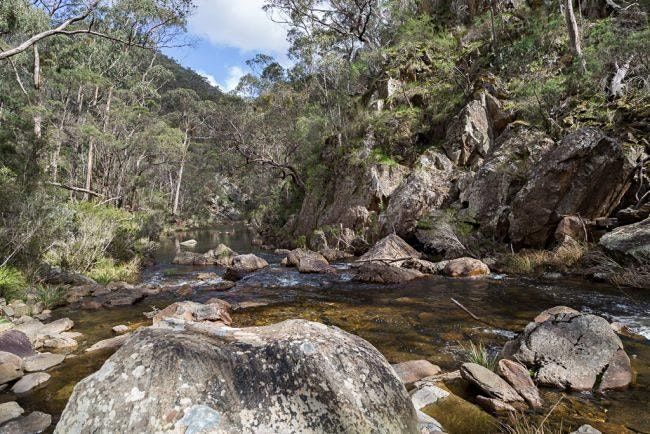
This walk follows the river upstream to Grahams Dam and up Link No 1 track for our only climb. It will be challenging but you will be rewarded with amazing views of Lerderderg State Park and farming land towards Melbourne and beyond.
The trail also includes water crossings (possibility of your feet getting wet) and one steep descent.
We then follow Blackwood Ranges Track on the top of the ridge until we meet Link No 2 Track where we begin our descent.
The walk back to MacKenzies Flat follows the river track and is a lovely way to finish a fabulous hike.
Walking notes:
Grading: 4 (only due to the steep climb & river crossings)
Start Time: 9.30am
Finish Time: 2.30pm
Hike Leader: Mel
Meeting Point: MacKenzie’s Flat Picnic Area, Lerderderg Gorge Road, Bacchus Marsh
Phone reception: intermittent
Weather and hazard notes: River flooding if extreme rain. Slippery clay
Toilet access: MacKenzies Flat Picnic Area only
Equip: Hiking boots & Poles recommended
Bring: adequate water, snacks and lunch
IMPORTANT NOTE:
Hi hikers. Just an update on hiking conditions on the Lerderderg Short Circuit hike for next Sunday. You will get wet feet on the river crossings as some of the stepping stones were washed away in the storms. You will need river shoes/sandals to cross & a towel to dry your feet.
Event Venue & Nearby Stays
Mackenzies Flat Picnic Area, Lerderderg George Road, Bacchus Marsh, Australia
AUD 0.00 to AUD 55.00