Advertisement
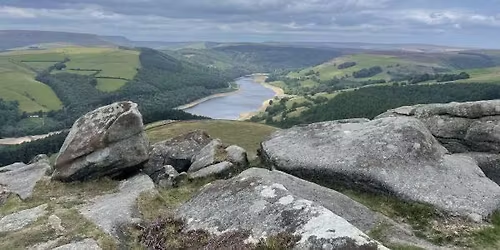
4 miles - booking essential, T&Cs apply Building on the learning from the Beginners course (map reading), a classroom presentation is followed by practice on a short walk around Edale. The course covers navigating using a map and compass. The features of the compass will be explained and the use and completion of route cards will be covered using 6-figure grid references; the different North points; map symbols; taking a bearing; walking on a bearing, pacing and timing using Naismith's Rule.
Event Terrain: Short sections along the road but mainly on good, well-drained footpaths across fields but one section over rough terrain and one ascent over rough terrain.
Event Grade: Moderate - moderate walks on ground with sometimes rough and uneven terrain and gradients.
Extra items: OS Explorer map (1:25,000) OL1 The Peak District - Dark Peak Area, Silva Expedition compass, or similar. Pen or pencil.
Meeting Point: Moorland Visitor Centre, Edale.
Grid Reference: SK124 856
Post Code: S33 7ZA
What3Words: youngest.hammocks.toasters
Parking: Parking is very difficult in Edale at busy times. No parking is available at the Visitor Centre. There is a Pay and Display car park near Edale Station. From the car park, walk under the rail bridge for 200 yards towards Edale Village. A number of nearby farmers are offering overspill parking in their fields. There are toilets at the P&D car park; none at VC.
Near A Rail Station: Yes. Edale Station lies on the Manchester-Sheffield rail line. From the station, walk under the rail bridge for 200 yards towards Edale Village.
No dogs allowed on this particular event.
Advertisement
Event Venue & Nearby Stays
The Moorland Visitor Centre, Edale, Pod Point, Hope Valley, S33 7, United Kingdom, Hull End
Tickets