
About this Event
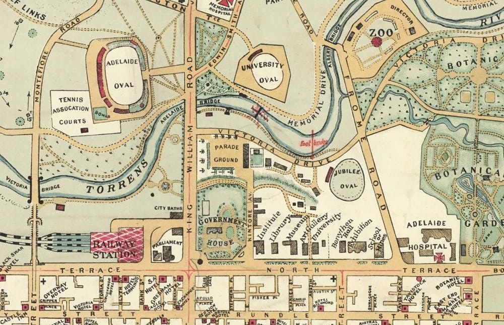
William Herbert Edmunds created exquisite hand drawn maps of Adelaide, the suburbs and the hills, and some country localities – such as Bagot’s Well, Clare, Port Victor and Mt Gambier. The State Library’s Map Collection preserves 18 of these maps, which date from 1914 to 1940. See these maps in all their glory in a talk and slideshow, which also reveals the man behind the maps in his other lives as soldier and sportsman. WH Edmunds became interested in mapping during the South African War with the 5th South Australian Imperial Bushmen. Joining the Survey Department he produced the state’s first topographic map in 1914. His touristy road maps were produced on his weekends and in retirement.
Event Venue & Nearby Stays
State Library of South Australia - Hetzel Lecture Theatre, North Terrace, Adelaide, Australia
AUD 0.00